54k+
polygons processedClosed areas merged and analyzed
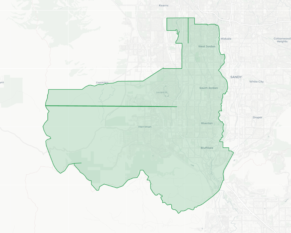
Built for KML/KMZ files that already contain closed area polygons. Use true geometric union (dissolve) to turn fragmented areas into one clean boundary for Google Earth, QGIS, agriculture, and drone mapping.
Merge my polygonsSupport via email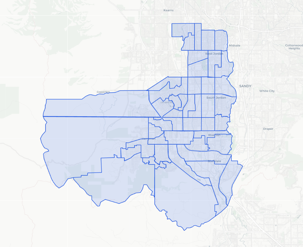
Watch a real workflow showing KML Unifier merging separate KML/KMZ polygon files into one clean boundary — ready for Google Earth, QGIS, farm mapping and GIS workflows.
KML Unifier is already processing KML/KMZ polygon data from agriculture, drone mapping, GIS cleanup and Google Earth workflows across multiple countries.
Closed areas merged and analyzed
Uploaded for real workflows
Global usage footprint
Mapped area handled
Merge multiple KML/KMZ polygons into one clean boundary in seconds.
Limits: Free plan: up to 3 files. Paid plans: up to 300 files. Max 2.00 MB each and 20.00 MB total per upload.
Drag & drop .kml/.kmz files here — we’ll merge them into one final boundary
Multiple files supported. Preview free, pay only to unlock the final fileDrag and drop KML/KMZ files containing the polygons you want to merge—field boundaries, application areas, parcels, project sites, and more.
Our backend performs a geometric union (dissolve) to merge all polygons into a single boundary.
Get a single KML output ready for Google Earth, GIS tools, drones, and field operations.
We’re building an official API for automated KML polygon merging. Integrate it directly into agritech platforms, GIS pipelines, drone mapping workflows, or your own software.
Coming soon.
Join the waitlist to hear when API access opens for automated workflows and integrations.
No spam. We’ll only email you when the API launches.
Click Upload, select multiple .kml files, and run the merge. You’ll get one unified boundary to download and use in Google Earth or GIS tools.
Yes. You can upload .kmz files and merge them the same way. The output is a single unified boundary ready for your workflow.
Yes. The merged output is compatible with Google Earth. A common workflow is: export your polygons, merge them here, then open the final unified boundary in Google Earth.
The tool combines all uploaded polygons into a single boundary (often called merge, union, or dissolve). If polygons are close, you can optionally connect them using corridors.
Small differences can happen due to geometry cleanup, projection adjustments, and optional corridor creation. In most mapping and planning workflows, these differences are minimal.
Currently, .kml and .kmz are supported. Other formats (like GeoJSON) may be added later.
Yes. It’s commonly used by consultants and teams working with agriculture mapping, drones, surveying, engineering, and GIS projects.